 BGS Data Catalogue
data.gov.uk (non-INSPIRE)
Type of resources
Available actions
Topics
Keywords
Contact for the resource
Provided by
Years
Formats
Representation types
Update frequencies
Service types
Scale
Resolution
-
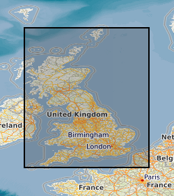
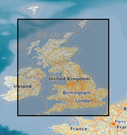
The 5km Hex GS Landslides dataset shows a generalised view of the GeoSure Landslides v8 dataset to a hexagonal grid resolution of 64.95km coverage area (side length of 5km). This dataset indicates areas of potential ground movement in a helpful and user-friendly format. The rating is based on a highest level of susceptibility identified within that Hex area: Low (1), Moderate (2), Significant (3). Areas of localised significant rating are also indicated. The summarising process via spatial statistics at this scale may lead to under or over estimation of the extent of a hazard. The supporting GeoSure reports can help inform planning decisions and indicate causes of subsidence. The methodology is based on the BGS Digital Map (DiGMapGB-50) and expert knowledge of the behaviour of the formations so defined. This dataset provides an assessment of slope instability. Landslide hazard occurs due to particular slope characteristics (such as geology, gradient, sources of water, drainage, man-made constructions) combining to cause the slope to become unstable. Downslope movement of materials, such as a landslide or rockfall may lead to a loss of support and damage to buildings. Complete Great Britain national coverage is available.
-

Scanned collection of seismological journals and offprints. The original collection was compiled by John Wartnaby. John Wartnaby was a curator at the Science Museum, London, and wrote a historical survey of seismology and scientific instruments. His accumulated papers consist chiefly of offprints and articles, and many older British Association seismological reports. The collection is part of the National Seismological Archive.
-

This is a collection of extracts from British newspapers describing earthquakes, mostly British. It contains original clippings, photocopies, and in a few cases manual transcriptions.
-
Collections of miscellaneous items mainly of semi-current value, including some field observations supplementary to 1:10560/1:10K mapping, arranged on 1:10K or One-Inch sheet basis. Set up in 1950's filing miscellaneous records for Scotland and Northern England. Records of archival value for permanent retention being transferred to Land Survey Archives (LSA). Indexed in the Land Survey Record Index (LSRI).
-

Sometimes known as the "One-Inch Collection", this is an archival collection of rock samples collected by BGS field staff during surveys within England and Wales, arranged by 1-inch (or 50 K) scale BGS geological map sheet area. It was intended as a representative suite of the lithologies present in each sheet, although this was only partially achieved. Documentation is via archive of rock sample collection sheets (see COLLECTIONSHEETS) but is poorly coordinated at present.
-

Rocks, thin sections and paper registers: samples from past BGS surveys and projects overseas. Though neglected for several years, the collection has been re-opened for addition of new material from overseas projects and donations. Paper registers are arranged by accession order on a country by country basis. The records have not been placed in electronic format and are not currently machine readable.
-

Registers dating from the 1950s listing some of the macrofossil collections held in the Geological Survey of Ireland between 1868 and 1875. They are numbered sequentially, but as they are a selection only, there are some gaps in the numbers. Numbers included are: I1-4893; K1253-4937;L319-3247;N961-3066;O4521-5000; P1-4393; R1-1270;S1978-2099; T1-500 and U1-2113.
-
Records of all onshore (or near shore) boreholes, trial pits, shafts and wells held in the BGS archives in either paper, microfilm or digital format. The records range from simple single page lithological logs through to hydrocarbon completion reports. Spatial coverage will vary considerably depending on drilling activity, collecting activity and donations. The majority of new data is from site investigation reports with concentrations in urban areas and along transport routes. Current collection over 1million records covering the whole of Great Britain with 50,000 new records added per annum. Some records date back to 1600 but the majority date from 1900 onwards. Copies of records are available in hard copy or digital formats subject to confidentiality.
-
All data dictionaries held in Oracle. They include both administrative (e.g. codes for companies), scientific (e.g. codes for deformation episodes) and geographic (e.g. codes for countries). Typically, they are used to constrain the allowable values held in other Oracle datasets. In some cases they are an implementation of the classifications that the BGS uses in its work.
-
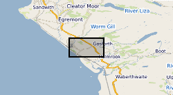
A collection of reference drawings relating to investigations carried out by Nirex, during the period from 1989 to 1997. The drawings summarise the status of the geological investigation at Sellafield and include borehole locations, geology (surface, structure, sections etc) and geophysics (seismic, airborne, etc). Sites near Sellafield, in Cumbria, and Dounreay, in Caithness. The Nirex (Nuclear Industry Radioactive Waste Executive) geological archive was transferred to the British Geological Survey during 2000/2001. The BGS has undertaken to retain the records for a minimum of 50 years as part of its national geological archive. The ownership of Nirex was transferred from the nuclear industry to the UK Government departments DEFRA and DTI in April 2005, and then to the UK's Nuclear Decommissioning Authority (NDA) in November 2006.